



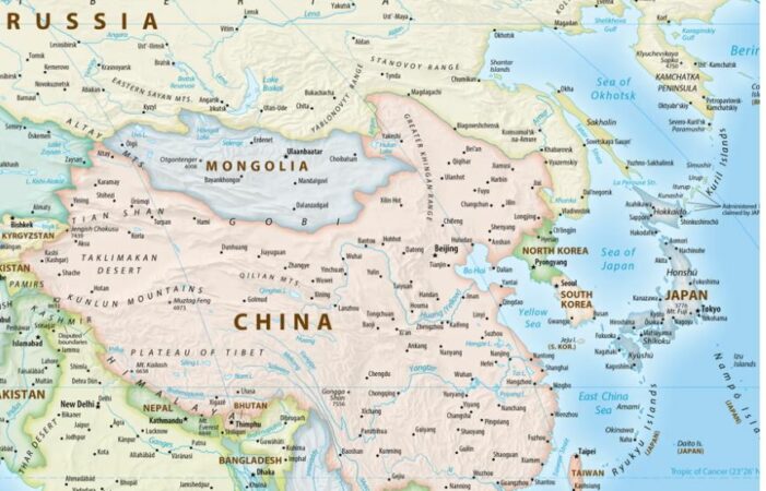



Japan has asked the operator of a new world map approved by the United Nations to correct the appearance of the Kuril Islands, which Tokyo considers part of its territory.
The Japanese government has officially protested, as the new map shows the disputed islands in the same color as Russian territory, creating a misconception about their status.
The United Nations General Assembly voted Friday to approve the new map, known as the “Equal Earth” projection. Japan was among 164 countries that voted in favor of the resolution, but later raised concerns about how the Kuril Islands, known in Japan as the “Northern Territories,” are depicted.
Japanese government spokesman Minoru Kihara said on Thursday that the map contains a representation that contradicts Japan's official position. He said Tokyo has lodged a protest with the map website operator through diplomatic channels, demanding its correction.
"We need to prevent the spread of misunderstandings regarding territories and geographical names," Kihara told reporters. He did not say when the Japanese government was informed about how the islands were shown on the new map.
The new map has also sparked other international debates. It shows Africa in larger sizes, while Europe and North America are smaller than traditional maps. According to the United Nations, the goal is to provide a more accurate representation of the true size of the continents, unlike the traditional Mercator projection.
Ukraine also joined the debate, having abstained from the vote last week. Ukrainian representatives raised concerns that the occupied Crimea was being presented in a different light from the rest of Ukraine. They warned that such a presentation could open a “Pandora’s box” and create problems with the UN Charter and international law.